


EGYPT MAP
www.Cairoindex.com


Egypt , officially the Arab Republic of Egypt, is a country mainly in North Africa,
with the Sinai Peninsula forming a land bridge in Southwest Asia. Thereby,
Egypt is a transcontinental country, and is considered to be a major power in North Africa,
Mediterranean Region, African continent, Nile Basin, Islamic World and the Red Sea.
Covering an area of about 1,010,000 square kilometers (390,000 sq mi),
Egypt is bordered by the Mediterranean Sea to the north, the Gaza Strip and Israel to the northeast,
the Red Sea to the east, Sudan to the south and Libya to the west.

-- Egypt Map --
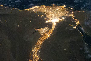
Egypt is one of the most populous countries in Africa and the Middle East.
The great majority of its estimated 77.4 million[1] live near the banks of the Nile River,
in an area of about 40,000 square kilometers (15,000 sq mi), where the only arable
agricultural land is found. The large areas of the Sahara Desert are sparsely inhabited.
About half of Egypt's residents live in urban areas, with the majority spread across the
densely populated centres of greater Cairo, Alexandria and other major cities in the Nile Delta.
Egypt is famous for its ancient civilization and some of the world's most famous monuments,
including the Giza pyramid complex and its Great Sphinx.
The southern city of Luxor contains numerous ancient artifacts,
such as the Karnak Temple and the Valley of the Kings. Egypt is widely regarded as an
important political and cultural nation of the Middle East.
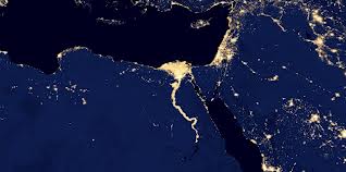
Egypt at night by satellite
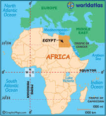
Egypt in Africa
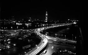
Cairo at night
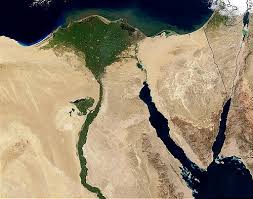
Egypt - Nile - Redsea
Egypt lights at Night by satellite